

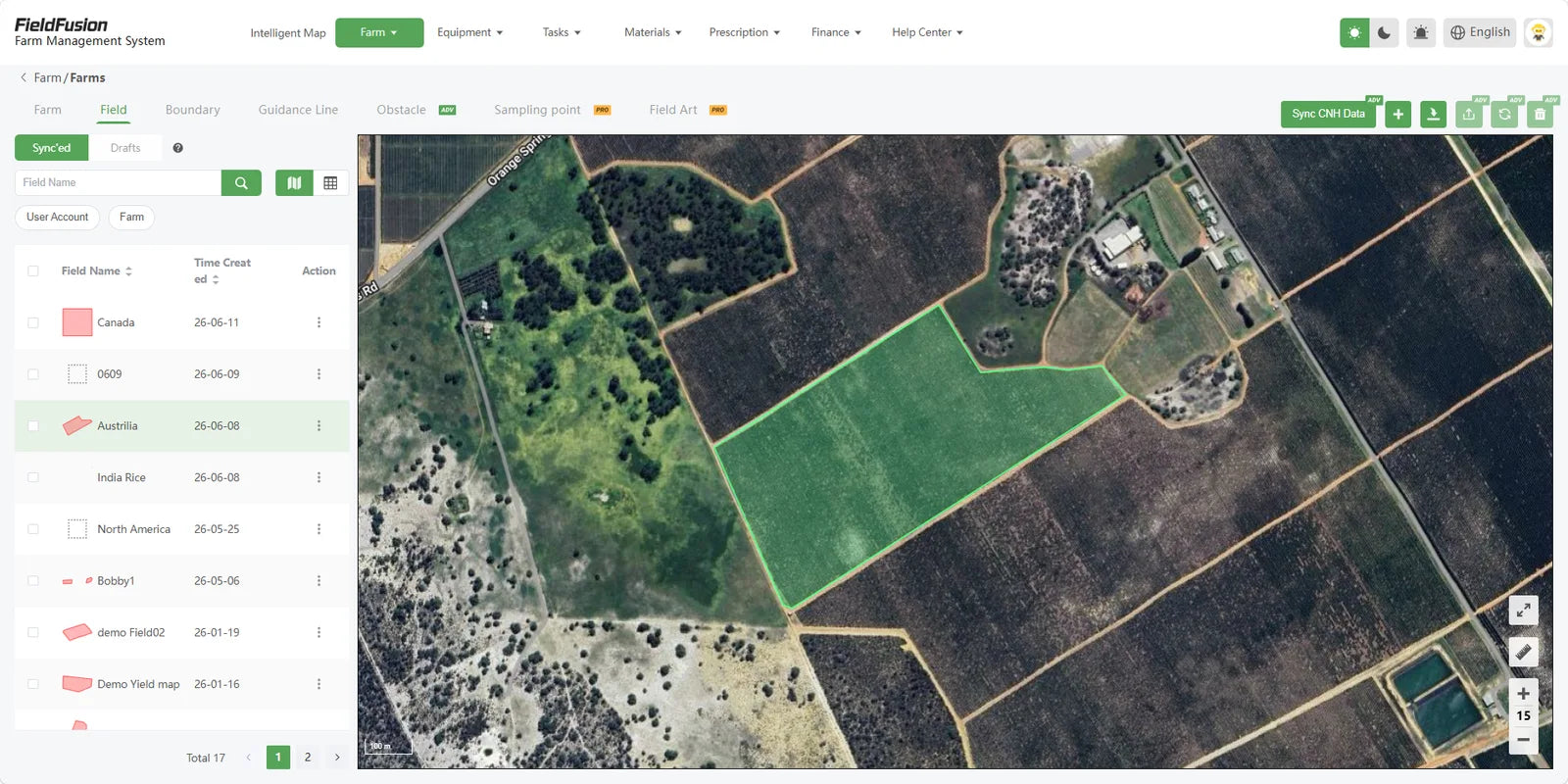
Save boundaries and area in one map
Create fields one by one or import existing boundaries. FieldFusion keeps the field name, shape, area, and map view connected.
Unlimited fieldsAutomatic areaBoundary map

Free field visibility
Create a free FieldFusion account to save unlimited fields, calculate field area, check local weather, and view satellite NDVI crop-growth maps from wherever you are.
Free registration Web + mobile access Your fields in one place

NDVI, made simple
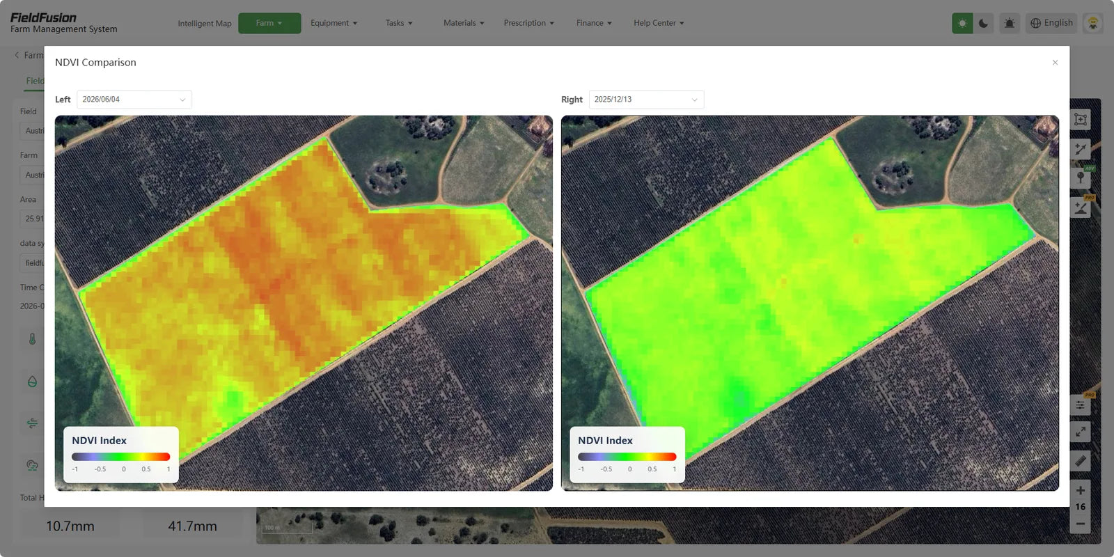
NDVI stands for Normalized Difference Vegetation Index. In plain language, it is a satellite-based color map that shows differences in crop vigor across your field.
Usually show stronger vegetation activity compared with the rest of the field.
Show weaker or changing areas that may be worth checking first.
See whether field conditions appear to be improving, declining, or staying stable.
NDVI points you to where to inspect first. Field scouting is still needed to confirm whether the cause is water, nutrients, pests, disease, or something else.
Your farm, organized
Draw or import field boundaries, keep an unlimited number of fields together, and open the details you need without searching through paper maps or old screenshots.
Create fields one by one or import existing boundaries. FieldFusion keeps the field name, shape, area, and map view connected.
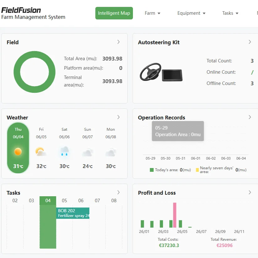
See farm information and weather in the same workspace before deciding when and where to go.
Start in minutes
Register with your email and set up your farm workspace.
Add as many fields as you need and let the system calculate area.
Open the satellite crop-growth layer and review variation across the field.
Use the map to focus field scouting instead of walking every acre blindly.
See change over time
A single image is useful. A comparison is better. Put two dates side by side to see which zones changed and decide where to inspect next.
Your fields go with you
Open FieldFusion on your computer or phone to keep field boundaries, area, weather, and crop-growth information close at hand.
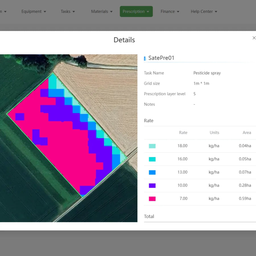
From insight to action
Use crop-growth zones to plan different rates for fertilizer, seed, or spray, then export a prescription file for compatible equipment. The goal is simple: put inputs where they are needed instead of treating every part of the field the same.
Prescription-map creation and export use eligible FieldFusion Pro features. Start with a free account and explore your fields first.
Good to know
Not automatically. Greener NDVI usually means stronger vegetation activity relative to other zones. Always use field scouting to confirm the cause.
NDVI highlights differences; it does not diagnose the exact cause by itself. It helps you choose where to inspect first.
No. Once your field boundaries are saved, you can return to the same field records and available imagery from your account.
Image availability and clarity can vary by date, location, crop cover, and clouds. Compare available dates and combine the map with what you see in the field.
Create your free FieldFusion account, add your fields, check area and weather, and use NDVI to know where to look first.

